


Central New Hampshire--Merrimack County (Central)--Concord City PUMA, New Hampshire
About
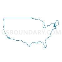
Outline
--Concord+City+PUMA%2c+New+Hampshire_A280.png)
Summary
| Unique Area Identifier | 193361 |
| Name | Central New Hampshire--Merrimack County (Central)--Concord City PUMA |
| State | New Hampshire |
| Area (square miles) | 684.79 |
| Land Area (square miles) | 667.60 |
| Water Area (square miles) | 17.19 |
| % of Land Area | 97.49 |
| % of Water Area | 2.51 |
| Latitude of the Internal Point | 43.25609790 |
| Longtitude of the Internal Point | -71.66154980 |
Maps
--Concord+City+PUMA in New Hampshire.png)
Graphs
Select a template below for downloading or customizing gragh for Central New Hampshire--Merrimack County (Central)--Concord City PUMA, New Hampshire
--Concord+City+PUMA%2c+New+Hampshire_T0.png)
--Concord+City+PUMA%2c+New+Hampshire_T1.png)
--Concord+City+PUMA%2c+New+Hampshire_T2.png)
--Concord+City+PUMA%2c+New+Hampshire_T3.png)
--Concord+City+PUMA%2c+New+Hampshire_T4.png)
--Concord+City+PUMA%2c+New+Hampshire_T5.png)
--Concord+City+PUMA%2c+New+Hampshire_T6.png)
--Concord+City+PUMA%2c+New+Hampshire_T7.png)
--Concord+City+PUMA%2c+New+Hampshire.png)
Neighbors
Neighoring Public Use Microdata Area (by Name) Neighboring Public Use Microdata Area on the Map
- Hillsborough County (Western) PUMA, NH
- Lakes Region--Belknap, Carroll & Merrimack (Northern) Counties PUMA, NH
- Outer Manchester City PUMA, NH
- Southwestern New Hampshire--Cheshire & Sullivan Counties PUMA, NH
- Strafford Region--Strafford, Rockingham (Northern) & Carroll (Southeastern) Counties PUMA, NH
Top 10 Neighboring County (by Population) Neighboring County on the Map
- Hillsborough County, NH (400,721)
- Rockingham County, NH (295,223)
- Merrimack County, NH (146,445)
- Strafford County, NH (123,143)
- Belknap County, NH (60,088)
- Sullivan County, NH (43,742)
Top 10 Neighboring County Subdivision (by Population) Neighboring County Subdivision on the Map
- Concord city, Merrimack County, NH (42,695)
- Goffstown town, Hillsborough County, NH (17,651)
- Hooksett town, Merrimack County, NH (13,451)
- Weare town, Hillsborough County, NH (8,785)
- Franklin city, Merrimack County, NH (8,477)
- Bow town, Merrimack County, NH (7,519)
- Belmont town, Belknap County, NH (7,356)
- Pembroke town, Merrimack County, NH (7,115)
- Hillsborough town, Hillsborough County, NH (6,011)
- Hopkinton town, Merrimack County, NH (5,589)
Top 10 Neighboring Place (by Population) Neighboring Place on the Map
- Concord city, NH (42,695)
- Franklin city, NH (8,477)
- Suncook CDP, NH (5,379)
- Hooksett CDP, NH (4,147)
- Henniker CDP, NH (1,747)
- Pittsfield CDP, NH (1,576)
- Contoocook CDP, NH (1,444)
- New London CDP, NH (1,415)
- Loudon CDP, NH (559)
- Warner CDP, NH (444)
Top 10 Neighboring Elementary School District (by Population) Neighboring Elementary School District on the Map
- Hooksett School District, NH (13,451)
- Weare School District, NH (8,785)
- Henniker School District, NH (4,836)
- Barnstead School District, NH (4,593)
- Epsom School District, NH (4,566)
- Allenstown School District, NH (4,322)
- Deerfield School District, NH (4,280)
- Northwood School District, NH (4,241)
- Strafford School District, NH (3,991)
- Candia School District, NH (3,909)
Top 10 Neighboring Secondary School District (by Population) Neighboring Secondary School District on the Map
- John Stark Regional School District, NH (13,621)
- Prospect Mountain High School Joint Maintenance Agreement District, NH (9,843)
Top 10 Neighboring Unified School District (by Population) Neighboring Unified School District on the Map
- Concord School District, NH (37,824)
- Goffstown School District, NH (17,651)
- Merrimack Valley School District, NH (17,407)
- Kearsarge Regional School District, NH (15,458)
- Winnisquam Regional School District, NH (11,362)
- Shaker Regional School District, NH (9,708)
- Franklin School District, NH (8,477)
- Hillsboro-Deering Cooperative School District, NH (7,923)
- Bow School District, NH (7,519)
- Pembroke School District, NH (7,115)
Top 10 Neighboring State Legislative District Lower Chamber (by Population) Neighboring State Legislative District Lower Chamber on the Map
- State House District 3, Strafford County, NH (28,372)
- State House District 7, Hillsborough County, NH (26,436)
- State House District 5, Belknap County, NH (24,325)
- State House District 6, Merrimack County, NH (20,216)
- State House District 11, Merrimack County, NH (17,306)
- State House District 1, Rockingham County, NH (17,215)
- State House District 10, Merrimack County, NH (13,671)
- State House District 9, Merrimack County, NH (13,451)
- State House District 8, Merrimack County, NH (12,994)
- State House District 12, Merrimack County, NH (11,718)
Top 10 Neighboring State Legislative District Upper Chamber (by Population) Neighboring State Legislative District Upper Chamber on the Map
- State Senate District 17, NH (58,086)
- State Senate District 16, NH (55,772)
- State Senate District 15, NH (55,399)
- State Senate District 7, NH (54,987)
- State Senate District 4, NH (54,249)
- State Senate District 8, NH (54,222)
- State Senate District 5, NH (53,856)
- State Senate District 20, NH (52,778)
Top 10 Neighboring 111th Congressional District (by Population) Neighboring 111th Congressional District on the Map
Top 10 Neighboring Census Tract (by Population) Neighboring Census Tract on the Map
- Census Tract 210, Hillsborough County, NH (8,785)
- Census Tract 9658, Belknap County, NH (7,356)
- Census Tract 32, Merrimack County, NH (7,115)
- Census Tract 255, Hillsborough County, NH (6,235)
- Census Tract 27.02, Hillsborough County, NH (6,029)
- Census Tract 442, Merrimack County, NH (5,646)
- Census Tract 390, Merrimack County, NH (5,589)
- Census Tract 405, Merrimack County, NH (5,559)
- Census Tract 360, Merrimack County, NH (5,317)
- Census Tract 328, Merrimack County, NH (5,100)
Top 10 Neighboring 5-Digit ZIP Code Tabulation Area (by Population) Neighboring 5-Digit ZIP Code Tabulation Area on the Map
- 03301, NH (33,008)
- 03303, NH (15,524)
- 03045, NH (13,560)
- 03106, NH (13,374)
- 03275, NH (11,437)
- 03281, NH (8,785)
- 03235, NH (8,562)
- 03276, NH (8,324)
- 03244, NH (8,092)
- 03304, NH (7,519)